

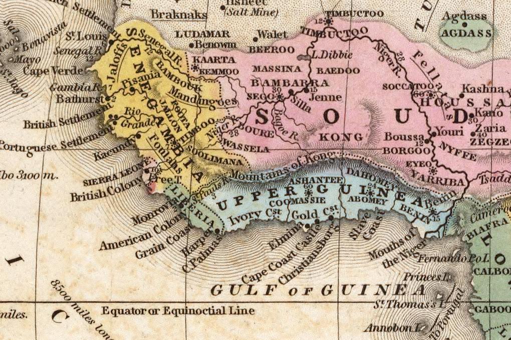
[Image: Mitchell 1839 detail. The Mountains of Kong, running east to west across an 1839 atlas. Fifty years before anyone checked. Public domain, via Wikimedia Commons.]
In 1798, an English cartographer called James Rennell drew a range of mountains across West Africa.
He’d never been there.
He was working from Mungo Park’s reports of hills to the south, and from a theory he had about where the Niger went. A long mountain range made that theory work. So he drew one.
Rennell had a reputation for being meticulous.
In 1802 Aaron Arrowsmith put the mountains on his map as a major feature of the continent. Other publishers updated theirs to match. In 1804 a German mapmaker added them as the Gebirge Kong. In 1805 a London engraver joined the range up to the very real range The Mountains of the Moon.
Nobody had been there.
Explorers went to West Africa: Caillié. Clapperton. The Lander brothers. They came back and produced maps.
The mountains were on them.
They’d walked the ground and yet they still drew the range, because the prior map was more authoritative than their own legs.
Two historians later counted forty published maps showing the Mountains of Kong between 1798 and 1892.
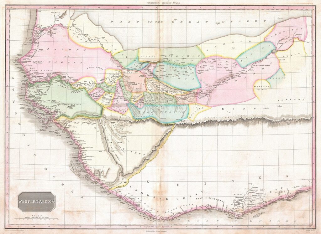
[Image: John Pinkerton, “Western Africa”, 1818. Scan by Geographicus Rare Antique Maps showing the Mountains of Kong. Public domain, via Wikimedia Commons..]
The range got more detailed as it endured. Heights. Extents. Coordinates.
The evidence stayed at zero.
A French officer called Binger finally settled it. Between 1887 and 1889 he walked to Kong. He found a town with mosques in it. No mountains.
The maps started dropping them.
Not all of them. In 1928, 130 years after they were hallucinated, and forty years after Binger corrected them, Bartholomew’s Oxford Advanced Atlas still listed the Mountains of Kong in its index.
With coordinates. 8° 40′ N, 5° 0′ W.
To the minute.
Of a place that has never existed.
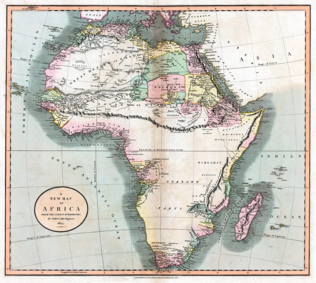
[Image: John Cary, map of Africa, 1805, showing the Mountains of Kong joining with The Mountains of the Moon. Public domain, via Wikimedia Commons. Sourced from Princeton University Library, “To the Mountains of the Moon: Mapping African Exploration, 1541-1880]
Nobody lied at any point in that story.
Rennell extrapolated. Arrowsmith trusted Rennell. Everyone else trusted the last map they looked at.
The error survived a century because copying is cheaper than checking.
Hold that thought.
A few days ago someone on our team asked our internal AI assistant a question about our own product. “Does Tyk support this, in this configuration?”
The answer came back in fifteen seconds. Confident. Formatted. A primary recommendation and a fallback option.
It was wrong.
Not vaguely. Specifically. It named capabilities we do not have.
So we made it show its work.
It went back through its sources and produced them, line by line, and here’s the thing.
Every fabricated claim had a real document behind it.
The first came from a customer meeting note where somebody had written that this was considered for the roadmap, but unlikely to be included anytime soon.
The second came from a meeting note from 2022, where a customer had asked whether we could do it.
A question. Not an answer. A question.
The model didn’t invent anything.
It couldn’t tell the difference between something we do, something we said we might do, and something somebody once asked us to do.
Retrieval has no tense and that’s the whole thing.
Your archive is not a record of what is true. It’s a record of what was said.
Meeting notes. Sales transcripts. Roadmap decks from two planning cycles ago. Threads where an engineer thought out loud. Aspirational one-pagers written to win an internal argument or explore a potential, imagined future.
All of it sits in the same index. Same font. Same confidence.
Nothing in a meeting note says this bit was a hope.
Then you ask an LLM a present-tense question and get a present-tense answer.
Because that’s what you asked for.
This hasn’t been a problem up until the arrival of LLMs
Humans read our archive. Humans knew which bits were promises and can understand the bigger picture.
The institutional knowledge was never in the documents. It was in the people who knew how to read them.
We’ve now handed the documents to something that wasn’t in the room.
And it reads them beautifully.
Better retrieval can help with this. Recency weighting, source ranking, forced citations, restricting the index to signed-off docs. We’re doing all of that. But an ambiguous corpus with better retrieval gets you a better-cited wrong answer. Arrowsmith’s map was excellent and that was the problem.
We could simply not index the mess stuff, but the messy stuff is where the value is. Customer meeting notes are the most useful corpus most product companies have. Index only the polished documentation and you’ve built a search box with worse latency.
The fix isn’t cleaner inputs or cleverer retrieval.
It’s Binger.
Somebody who has actually been to Kong. Someone reading what the machine said, and saying “no”.
Ours got caught in nine minutes because an engineer with direct knowledge read the channel, but that’s not a control. That’s luck with a rota, a different engineer may not have picked up on the issue in such a timely fashion.
And, yes. Kong. My closest competitor is called Kong. I did notice. I promise it isn’t why I picked the story, but I’m not going to pretend I didn’t enjoy it.
Rennell’s mountains spread across the map trade in about four years.
Yours will spread across your company in an afternoon.
A map is not a record of the land. It’s a record of the last map.
Your archive is not a record of what’s true. It’s a record of what was said.
That was fine for as long as only humans read it.
Further reading
- The Mountains of Kong
- Bassett and Porter, “From the Best Authorities: The Mountains of Kong in the Cartography of West Africa”
- The fabulous (and indeed false) Mountains of Kong
- Five root causes behind enterprise RAG hallucinations
- Open source built Tyk. It wouldn’t today.
- Tyk AI Studio: governing LLM and RAG access